End to End Imagery/Data Collection & Dissemination
Terrain360™ utilizes a variety of automated image capture vehicles for any terrain.
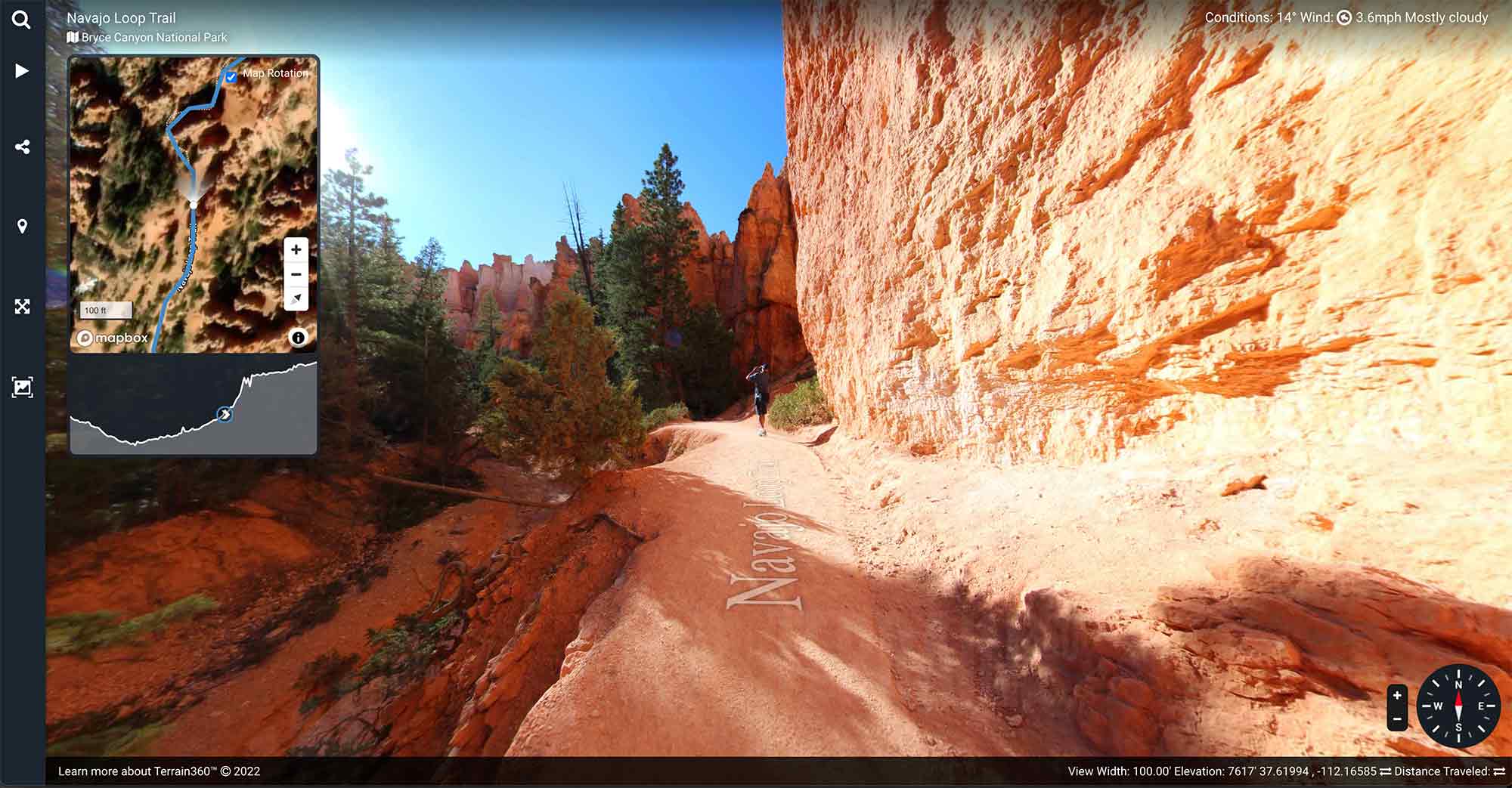
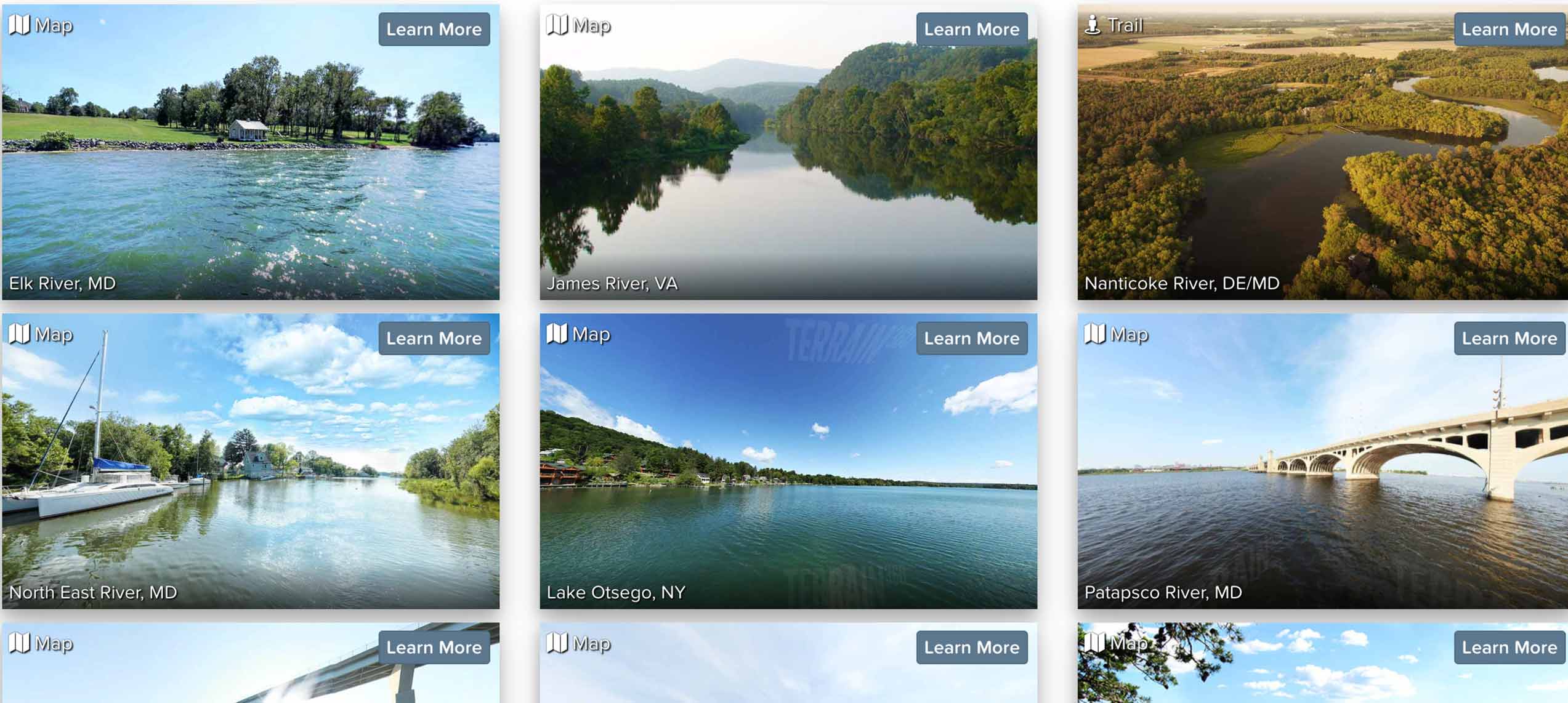
Terrain360 is a company that creates high-resolution, interactive panoramic maps of trails, waterways, and other outdoor recreation areas. Their maps allow users to explore and virtually experience these locations as if they were physically present there. The maps are created using specialized mapping technology, including specialized cameras and software. Terrain360 maps can be accessed online on any device.
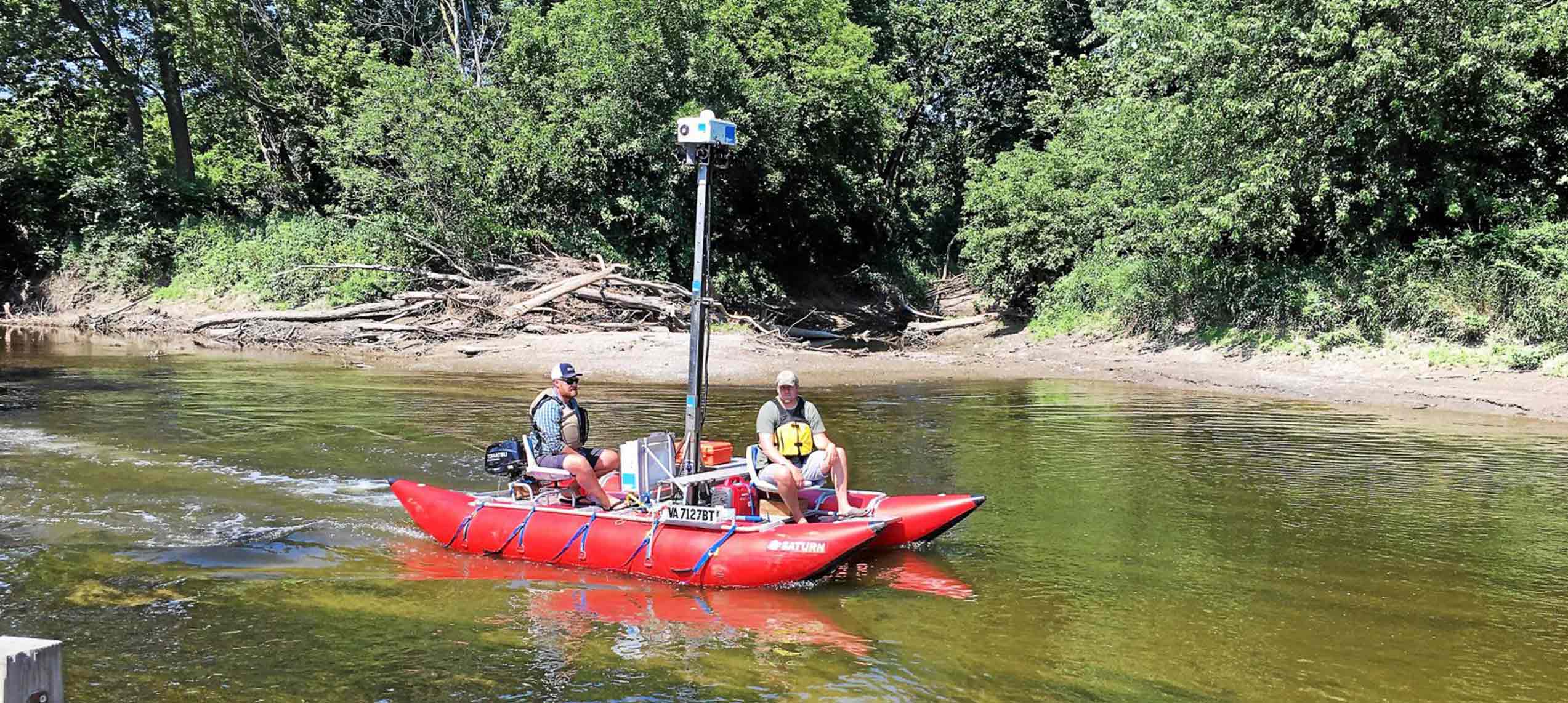
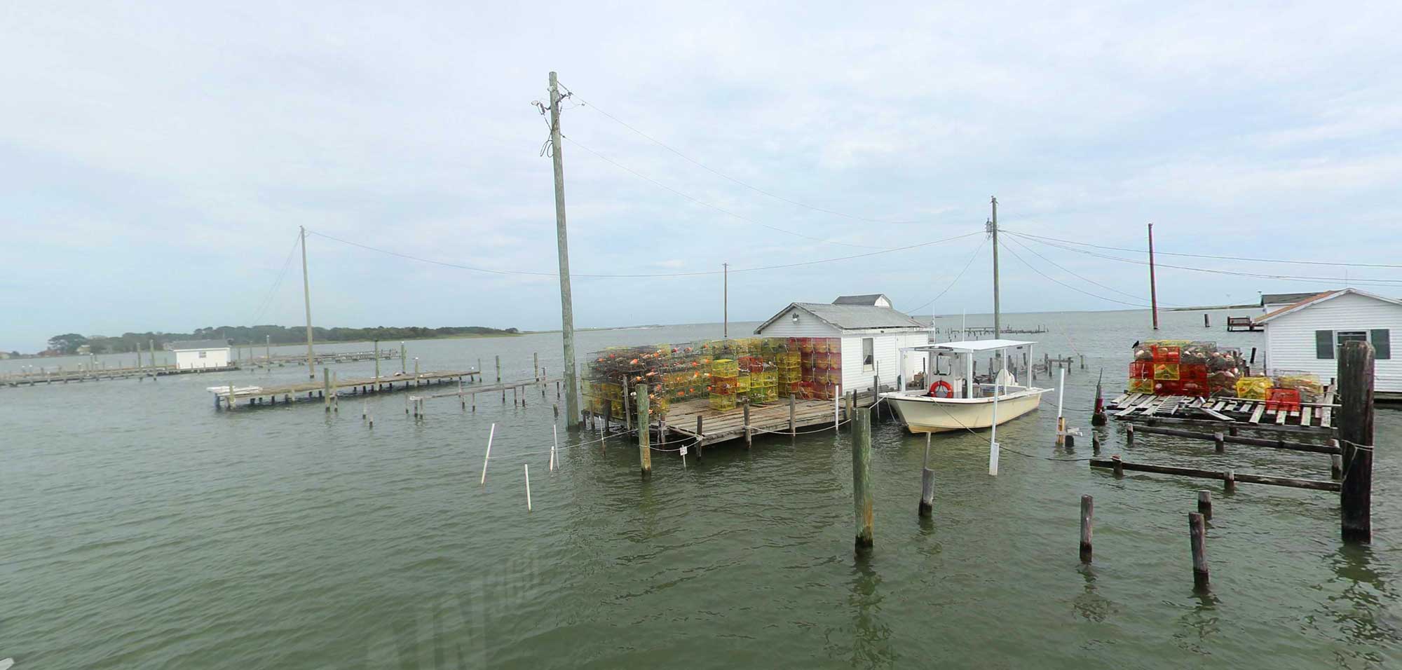
High resolution water based image data collection
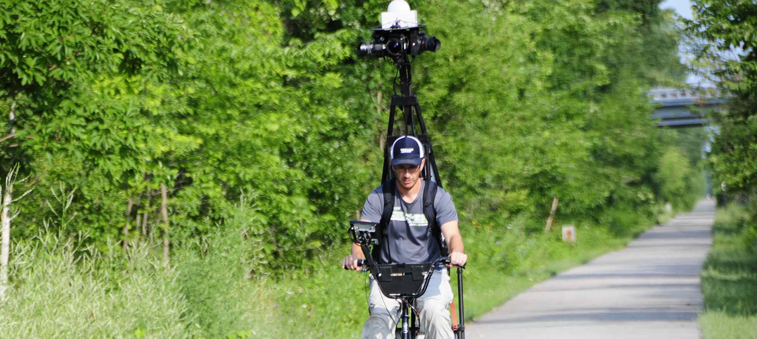
High resolution land based image data collection

Custom camera arrays for the highest resolution 360° imagery

Computer controlled image & data capture for quality control
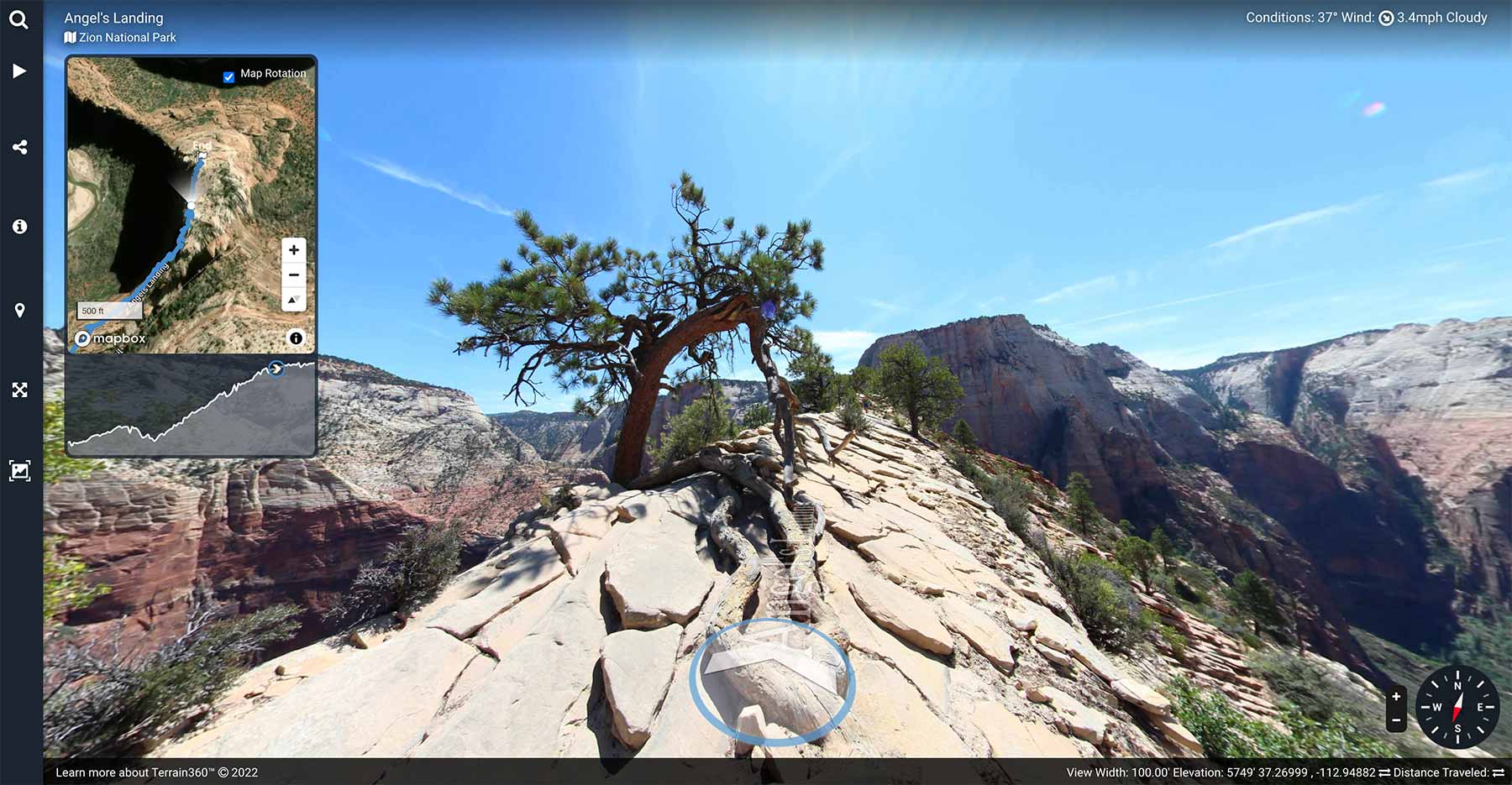
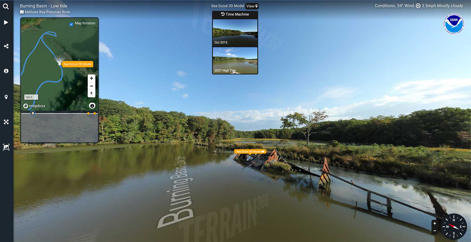
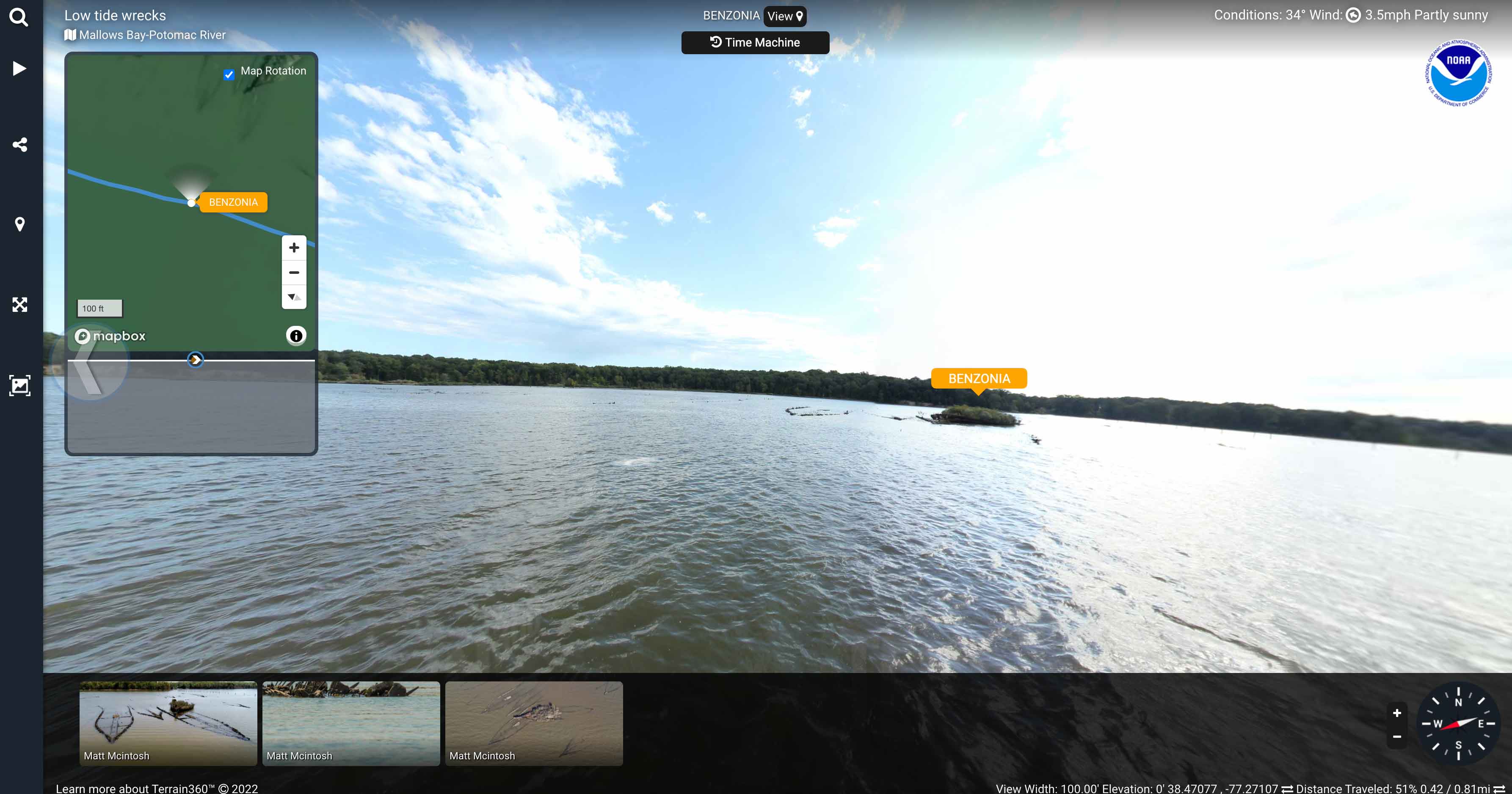
Introducing "Time Machine"
Digitally compare locations over time or compare high tide with low tide. Useful for measuring shoreline erosion, trail changes and environmental impacts over time
Digital Preservation
Terrain360 utilizes ultra high quality cameras for the best possible photography.
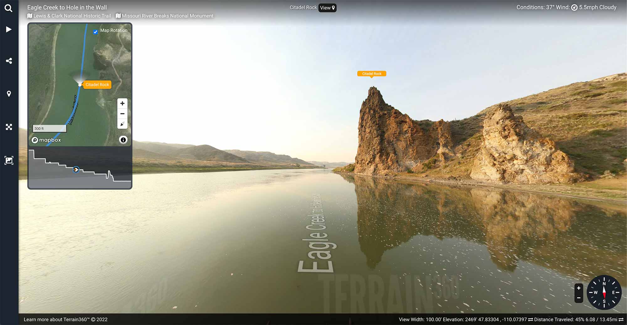
Interactive 360° virtual interface & exploration tools
See details that are only visible on the ground.
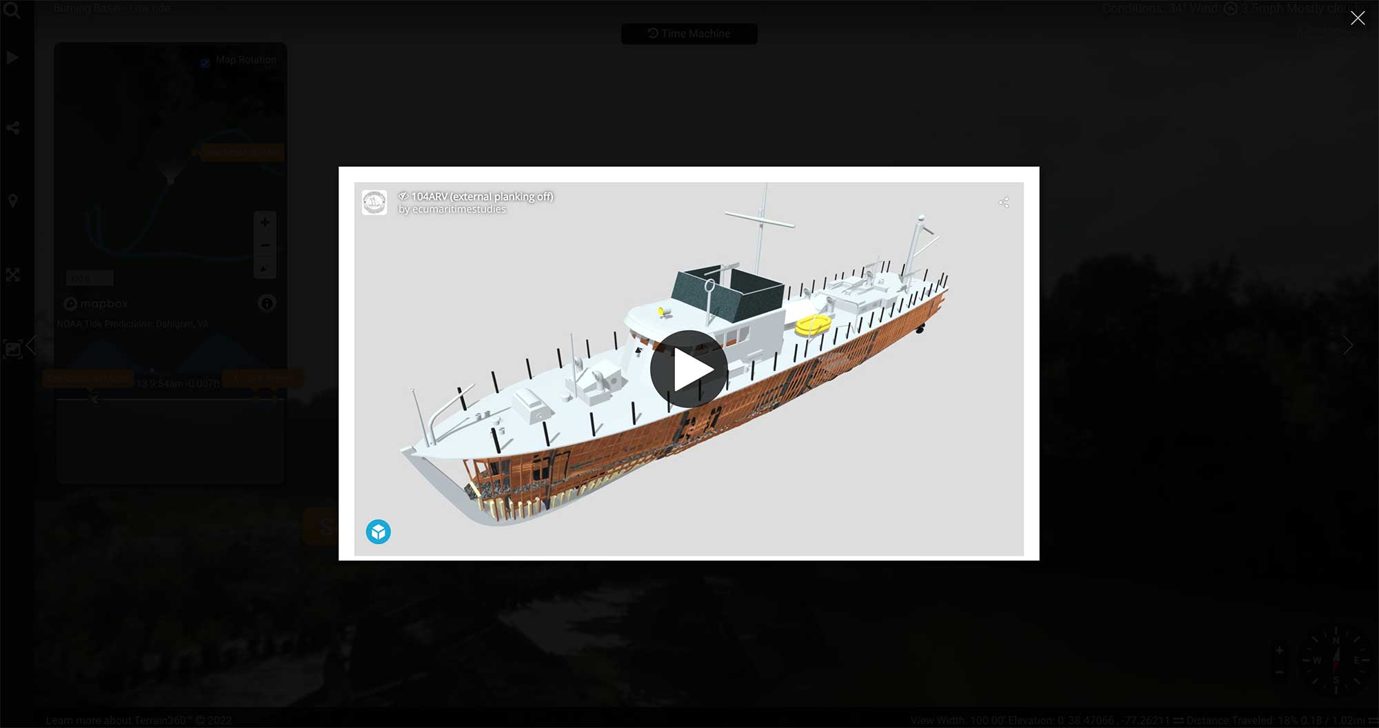
Integrate rich content including 3D Models, Live/Embedded Video, Audio, Gallery Images and stories
Simple integration into any website, app or GIS tool.
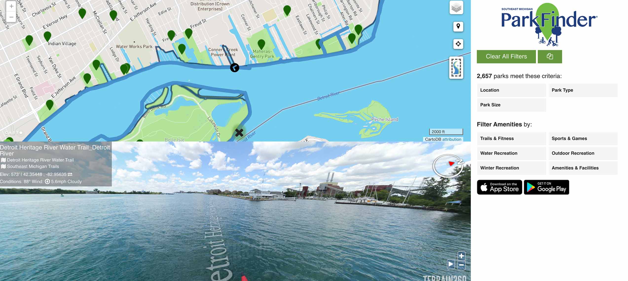
Rapid integration tools, include an SDK/API and iframe embeds
Showcase ecologically sensitive areas
Our mission is to learn about and document the places and people that are disappearing due to climate change